| 戻 る | 目次へ | 次 へ |
 |
関東大震災と館山 The Great Kanto Earthquake and its impact in Tateyama |
||
|
大正12(1923)年9月1日、相模湾を震源とするマグニチュード7.9の地震が、南関東を襲いました。震源域に近い千葉県南部の館山市から南房総市にかけての地域では、揺れや火災による家屋倒壊のほか、津波の襲来、地殻変動による隆起、地震断層の出現、土砂崩れ、液状化による噴砂など、地震によって発生する自然現象により土地が変化し、甚大な被害となりました。 とりわけ被害が大きかった内房の北條町 (現:館山市北条地区)や那古町(同那古地区)では、全壊家屋が96%を超え、液状化による地割れが発生しました。白浜(現:南房総市白浜町)では海岸部が1〜2メートル隆起し、高さ30メートル以上あった野島崎灯台が倒壊しました。 |
|||
| A powerful earthquake with a magnitude of 7.9 struck the Southern Kanto Region on September 1, 1923. The southern parts of Chiba Prefecture covering the areas of Tateyama-shi and Minamiboso-shi which were close to the epicentre of the earthquake in Sagami Bay, experienced destruction on a massive scale. In addition to the houses destroyed by the shock or fire, the land was changed by natural phenomena triggered by the earthquake, such as tsunami, tectonic uplifts, the emergence of earthquake faults, landslides and sand boils caused by liquefaction. In the towns of Hojo (the present Hojo district of Tateyama-shi) and Nago (the present Nago district of Tateyama-shi) in Uchibo, where the damage was particularly severe, more than 96% of the houses were completely destroyed and many ground cracks were induced by liquefaction. In the coastal area of Shirahama (in Shirahamamachi, Minamiboso-shi), the Nojimasaki lighthouse, which was over 30 metres high, collapsed due to the land uplifting by 1 to 2 metres. | |||
 |
|||
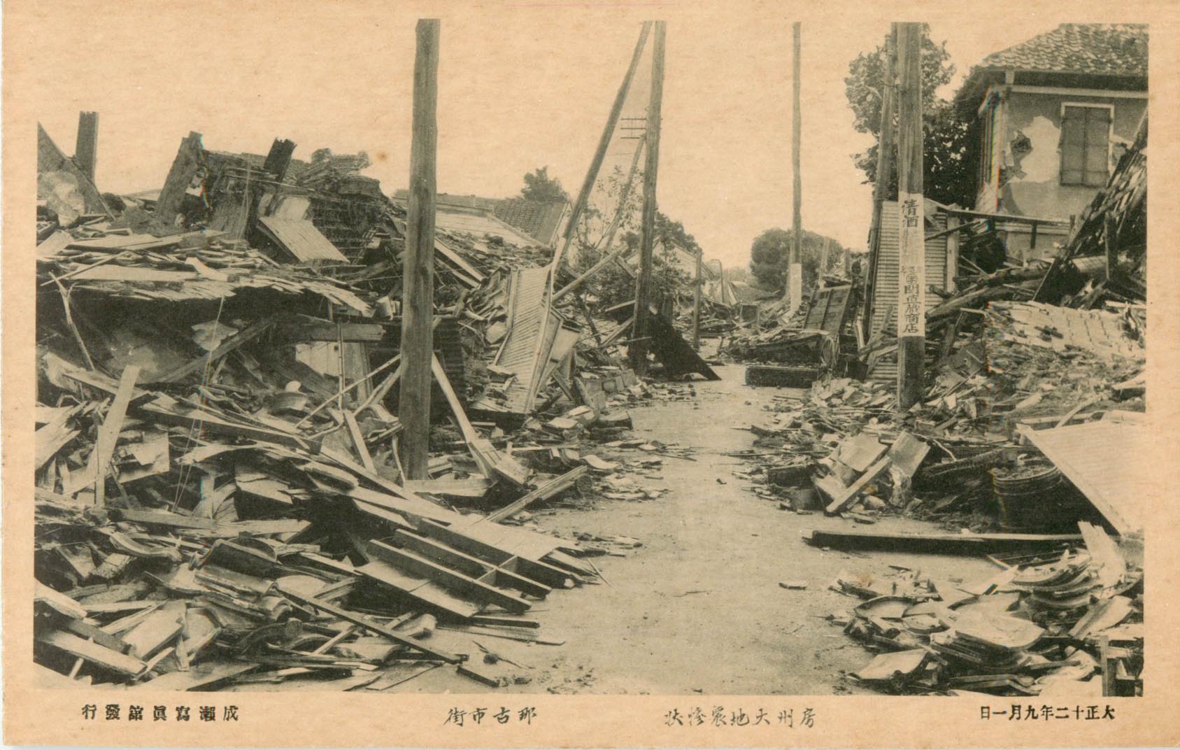 ▲ 房州大地震惨状 那古市街 |
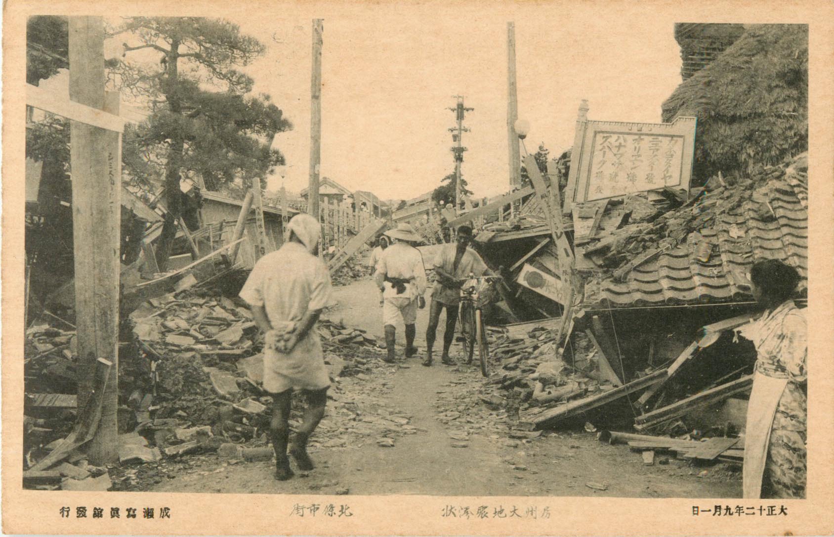 ▲ 房州大地震惨状 北條市街 |
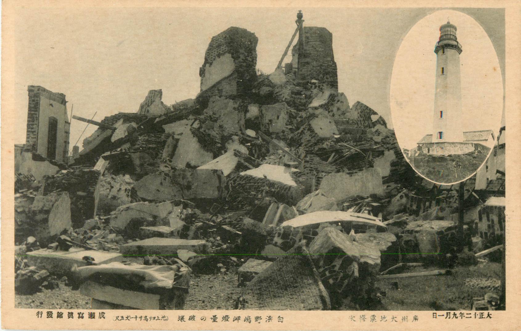 ▲ 房州大地震惨状 白浜野嶋崎燈台の破壊 |
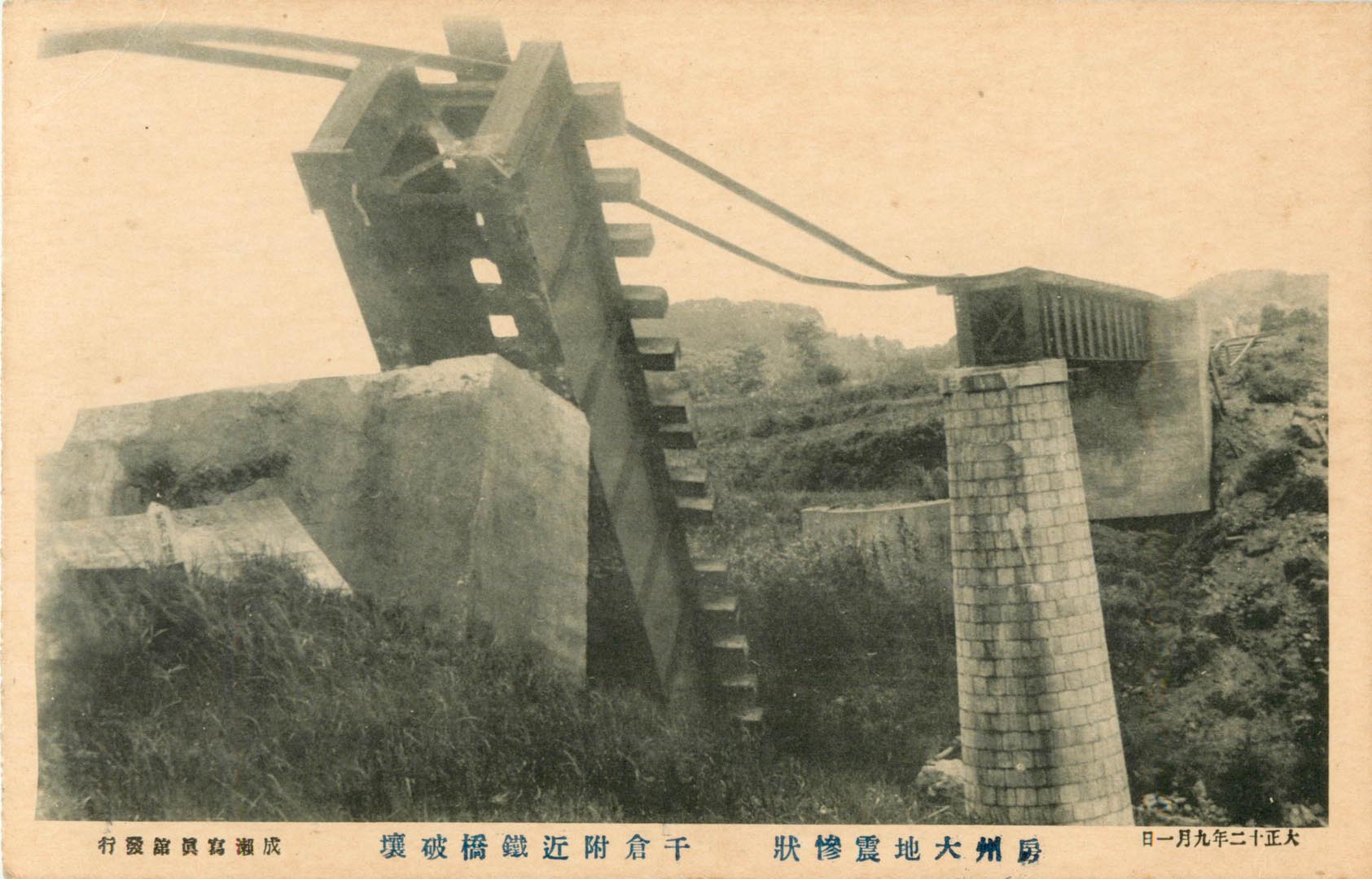 ▲ 房州大地震惨状 千倉附近鐵橋破壊 |
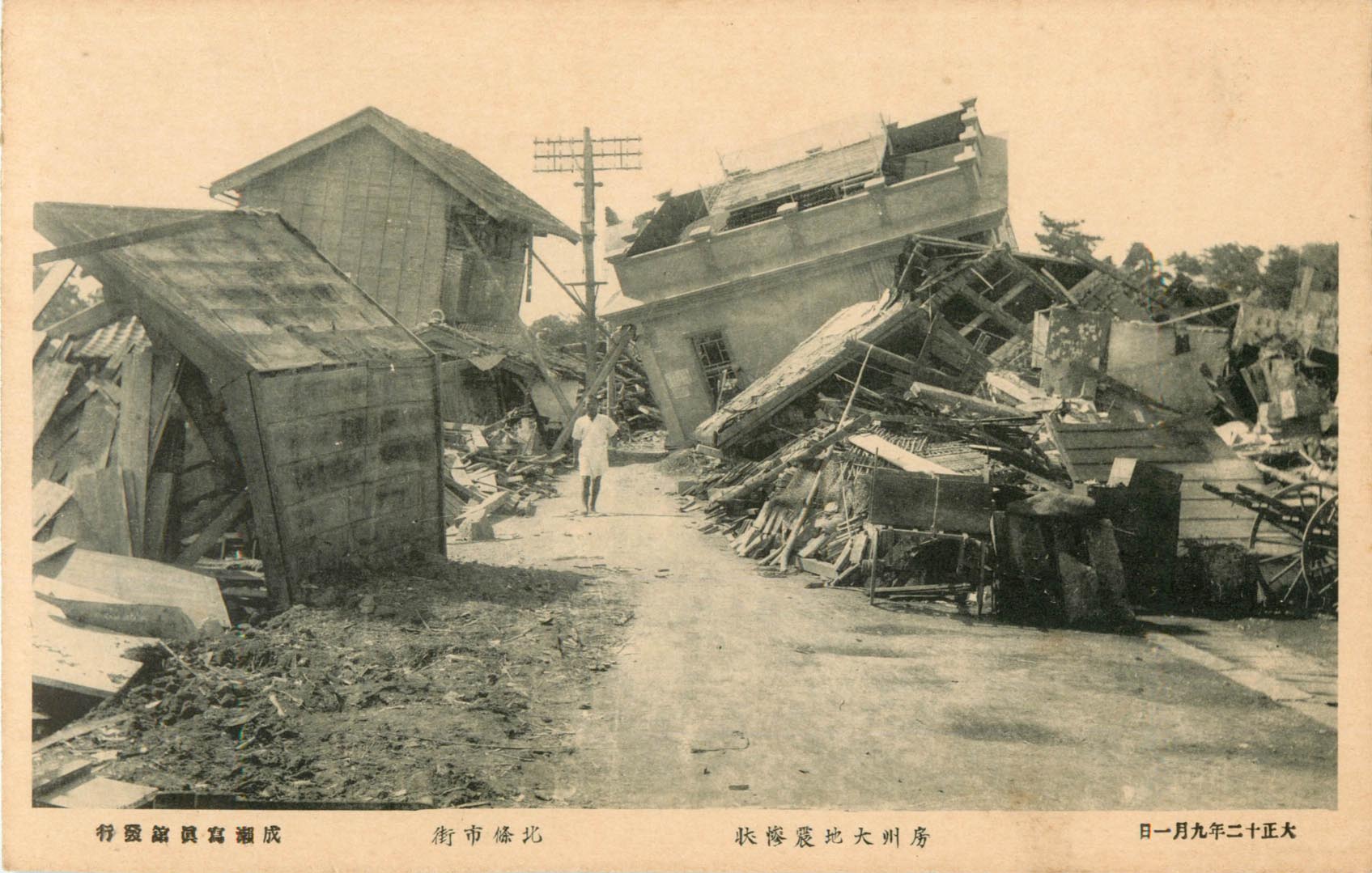 ▲ 房州大地震惨状 北條市街 |
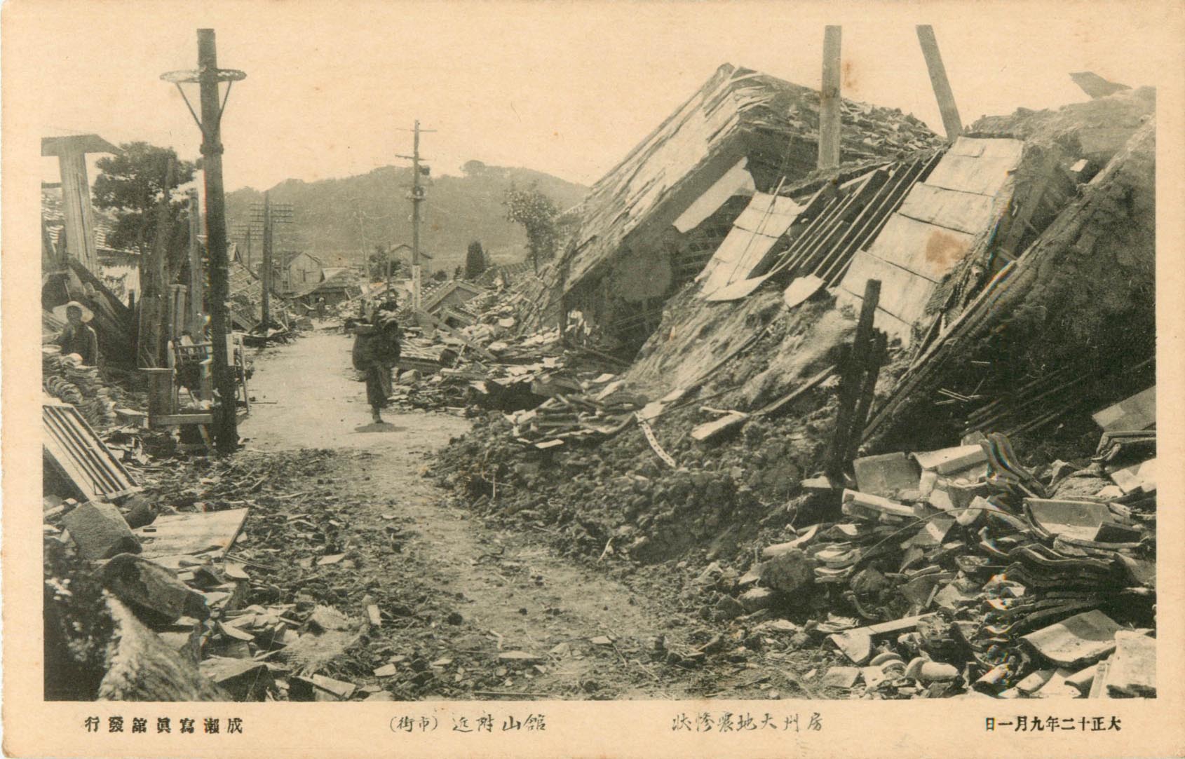 ▲ 房州大地震惨状 館山附近(市街) |
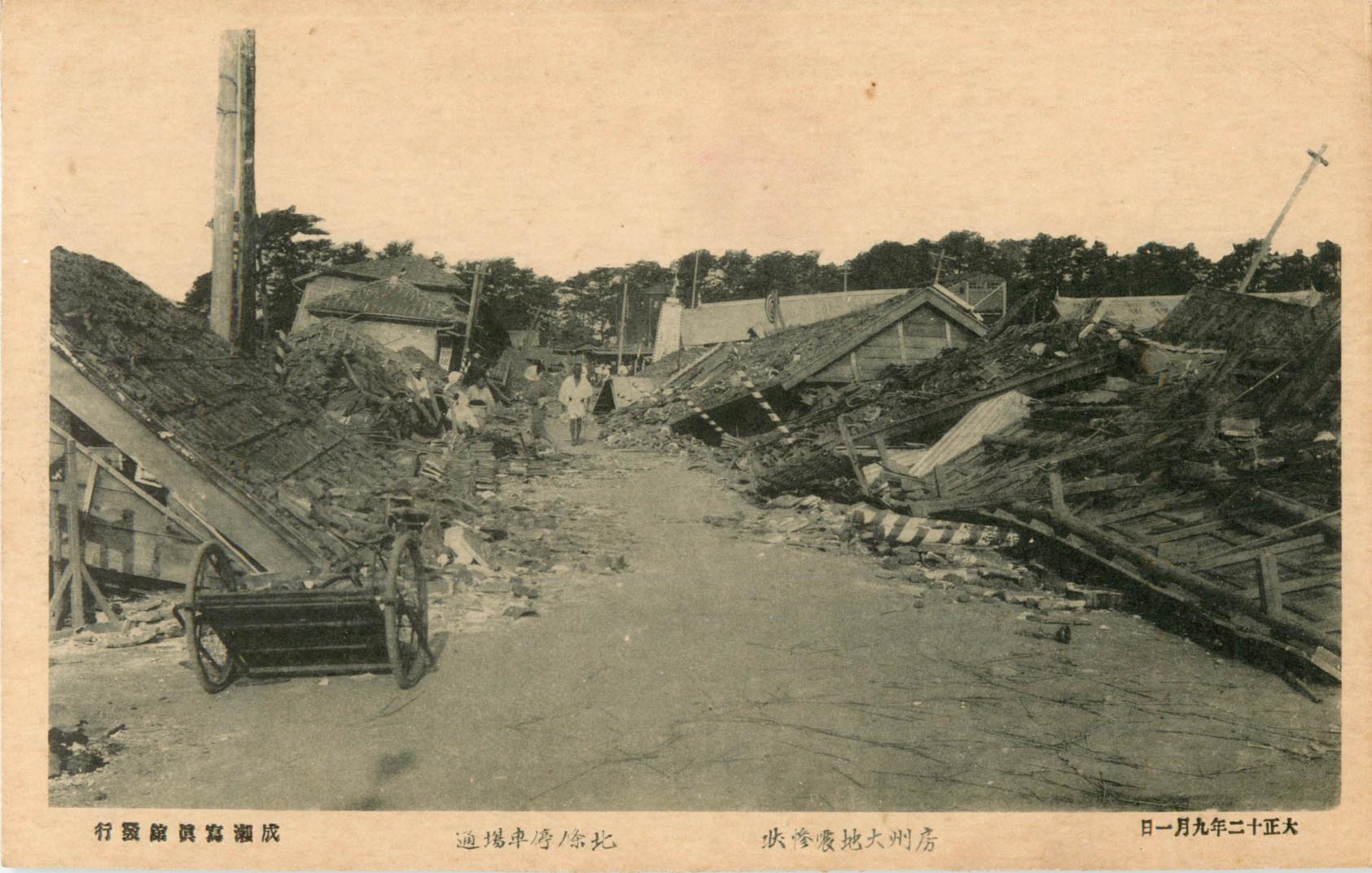 ▲ 房州大地震惨状 北條の停車場通 |
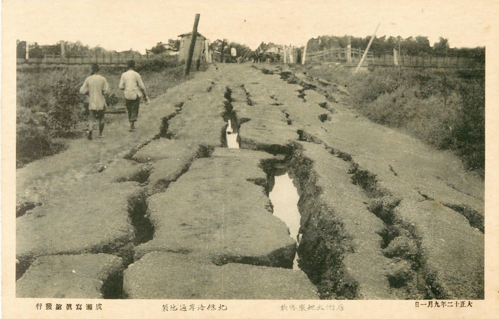 ▲ 房州大地震惨状 北條海岸通地裂 |
 ▲ 房州大地震惨状 那古市街 |
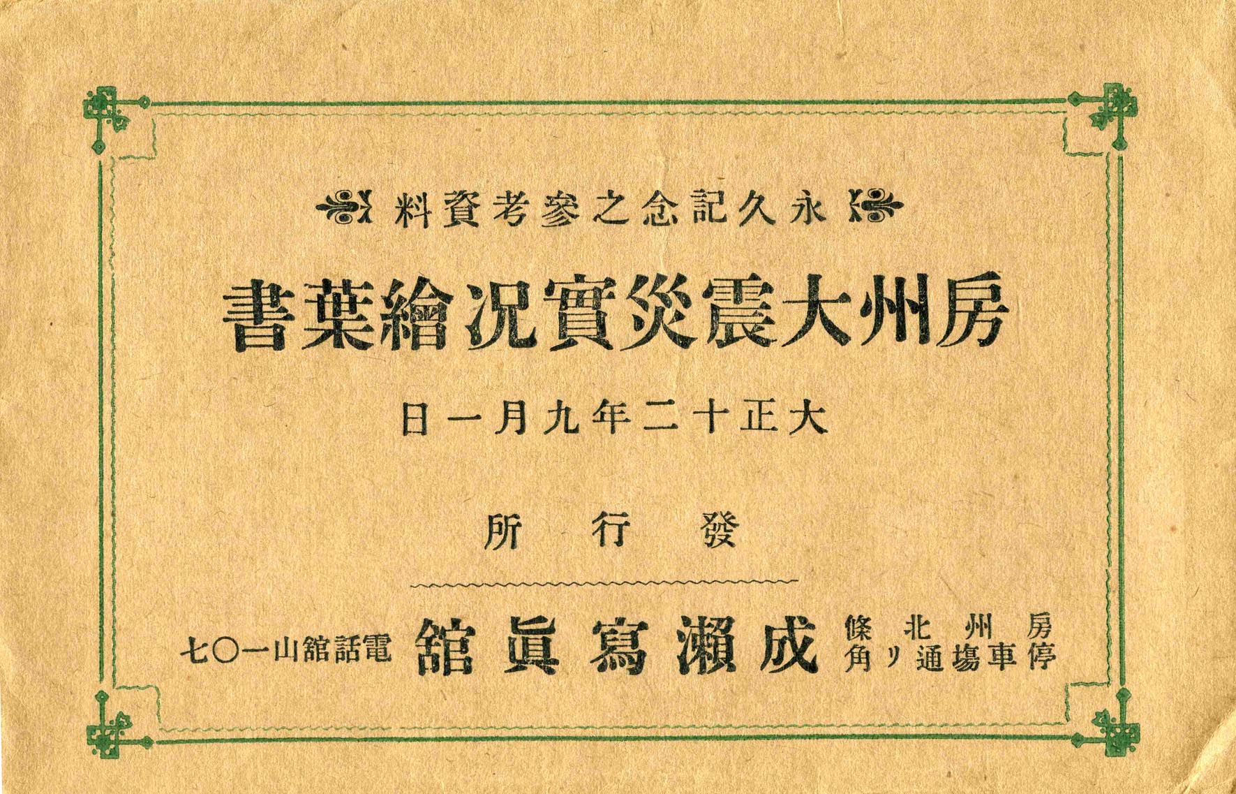
大正12(1923)年発行 館山の成瀬写真館が発行した「房州大震災実況絵葉書」、全8枚。北條や那古、白浜など、現在の館山市を中心とする地域の当時の被災状況を記録した貴重な資料である。 |
| 戻 る | 目次へ | 次 へ |